Mobile mapping generates vast geospatial data. This boosts personalized services and convenience. But, data privacy concerns loom large. Sensitive personal patterns can be exposed. Corporations might monetize this private data. It paves the way for potential security risks. It’s crucial users provide informed consent. Regulatory frameworks aim to safeguard privacy. Still, individual awareness and caution are key. Ensuring data privacy fosters trust in such systems.
What is Mobile Mapping ?
The global mobile mapping market was valued at $24.2 billion in 2021, and is projected to reach $127.3 billion by 2031.
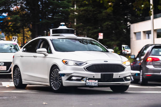
Mobile mapping refers to the process of collecting geospatial data using mobile devices or vehicles equipped with various sensors and technologies.
The goal of mobile mapping is to capture detailed information about the physical environment, such as roads, buildings, and landscapes, in a highly accurate and efficient manner.
The mobile mapping market is divided by applications; Aerial mobile mapping, Imaging services (Lidar zetc), Emergency response planning, Internet application, Satellite, Facility Management.
What are the existing Mobile Mapping systems ?
- Lidar
- 3D mapping
- Laser mapping
- Geopastial technology
Mobile Mapping stats :
The mobile mapping is seing an increase due to the expansion of smart cities urbanization and government initiatives in the world. :
- In 2021 the value of the market is $24,2 billion
- In 2031, the projection of the value will reach $127.3 billion
- The growth of mobile mapping systems has grown with 325% in 2021 according to AMR
- Market size in 2023 : USD 35.5 Billion
- Marketing Size in 2028 : USD 87.70 billion
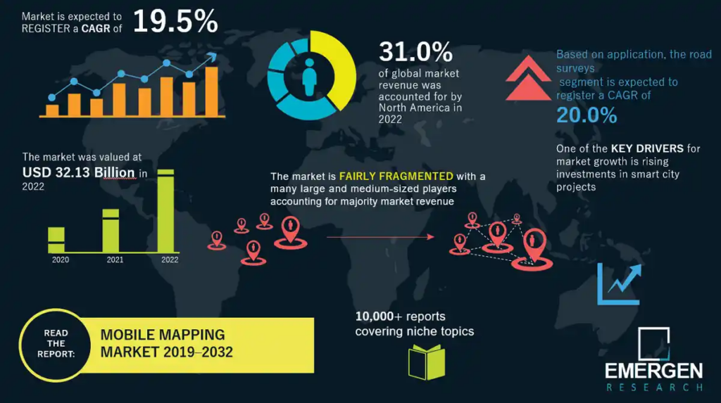
Emergen Research (2023). Mobile Mapping Market Infographic.
Data protection and Mobile Mapping :
Mobile mapping systems gather extensive geospatial data. This enhances personalization and user experience. But, it raises significant data privacy issues.
Because of the collection of data is carried out on urban roads, they capture automatically personal identifiers such as faces and license plates ; such sensors collects arounds 2 terabytes of data daily. Which implies that obtaining people’s consent is practically impossible regarding the number of people is captured.
This is where data protection laws come into play, particularly in Europe with the implementation of the General Data Protection Regulation (GDPR). As articulated through these articles:
- Lawful Basis for Processing (Article 6): Processing of personal data, including images, must be based on a lawful basis as defined in Article 6 of the GDPR. The lawful basis could be explicit consent from the individuals in the images or legitimate interests pursued by the data controller or a third party.
- Purpose Limitation (Article 5(1)(b)): Personal data should be collected for specified, explicit, and legitimate purposes and not further processed in a manner incompatible with those purposes. Blurring faces and license plates can be seen as a way to protect the privacy of individuals when the original purpose of capturing the images does not necessitate their identification.
In the US, one of the key elements of privacy protection under the California Act (CCPA) the blurring of personal identifiers in certain contexts, such as images and videos.
BlurIt : Easy and Swift Solution for Data Protection
BlurIt excels as a leading expert in data protection for the Mobile Mapping sector, leveraging its advanced artificial intelligence algorithm to ensure unparalleled security. We have perfected the art of safeguarding sensitive information by seamlessly blurring out personal identifiers within images and videos. Our solution is flexible and is usable through three versions (Online platform, API, On-premise ) depending on your needs.